| Corporate Overview | |
| Leadership | |
| Prequalification/Certification | |
| Diversity, Equity and Inclusion | |
| Service Brochures | |
| Locations | |
| How to Contact Us | |
| Civil Engineering | |
| Structural Design - Bridges / Buildings | |
| Bridges and Facilities Inspection | |
| Survey and Mapping | |
| Construction Inspection / Management | |
| Special Inspections & Material Testing | |
| Design-Build / Public-Private-Partnership (P3) | |
| Asset Management and GIS Application | |
| Traffic & Transportation Engineering | |
| Geotechnical Engineering | |
| CADD Conversion & 3D Animation | |
| Roads & Bridges | |
| Transportation Hubs and Facilities | |
| Rail/Transit Facilities | |
| Water and Wastewater | |
| Aviation & Ports Facilities | |
| Parking Facilities | |
| K thru 12 Facilities | |
| Higher Education Facilities | |
| Healthcare Facilities | |
| Laboratories & Science Facilities | |
| Residential and Housing Development | |
| Sports / Entertainment Complex | |
| Retail & Commercial Development | |
| Government / Judicial | |
| Corporate Culture | |
| Employee Benefits | |
| Current Openings | |
| Submit Resume | |
| News and Recent Wins | |
| Awards & Achievements | |
| Clients | |
PROJECT DATA SHEET PDF FORMAT
PROJECT NAME
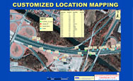
GIS Mapping and Inspection of 3,000 Drainage Outfalls along NJ Turnpike Milepost 83.50 to Milepost 105, Including the Hudson County Extension and Garden State Parkway from Milepost 81 to Milepost 125 (OPS No. A3059A)
PROJECT OWNER
New Jersey Turnpike Authority
PROJECT DESCRIPTION
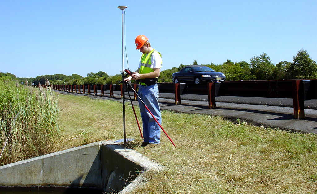
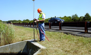
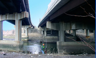
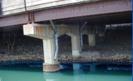
KS Engineers, P.C. (KSE) completed the enormous task of collecting GIS data, including location and physical attributes, and visually inspected approximately 5,400 stormwater outfalls along 250 miles of roadways on the New Jersey Turnpike and Garden State Parkway. The New Jersey Department of Environmental Protection, in 2004, released new regulations for controlling the discharge of pollutants into the state’s waterways from stormwater drainage systems. As part of this regulatory process, all public authorities–including highway authorities–in New Jersey were required to map the location and condition of all stormwater outfalls on their property.
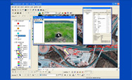
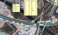
The field teams used Leica Geosystems’ GS20 Professional Data Mapper (PDM) handheld GPS/GIS Collectors with external antennae and Wireless Real-Time Corrections Systems which provided wireless beacon correction data for the GPS observations. In the office, the project team used Leica GIS DataPro software to process GIS and attribute data. Tools within ArcGIS were used to link digital images of each outfall to the shape files. Based on the outcome of this project, KSE suggested a few changes to Leica to improve the hardware components of the system, changes which were considered by the manufacturer. The magnitude and type of roadways along which the drainage outfalls were located made this project extremely complex and challenging in terms of safety and scheduling. A total of four teams were deployed in the field simultaneously. Due to greatly varied distance of the field work from the main office in Newark, New Jersey, the field team stayed in motels closer to segments of the roadways where work was being done in any given week. Using a secure FTP site, each evening the field teams transferred data to the main office servers. Close coordination with the Office
The outcome of this project was expected, in the long run, to save the client time and money by avoiding fines imposed by NJDEP. Additional as-built maps, with overlain aerial images, prepared under this project made the roadway maintenance personnel’s jobs a lot easier by allowing them to locate quickly any outfall on the busy and high-speed roadway system, and to know beforehand all the physical attributes of any particular drainage outfall along the heavily traveled high-speed highway system. KSE completed all project work within the scheduled timeframe and under budget.
In recognition of our work on this project, KSE received the 2007 National Recognition Award from ACEC National, the 2007 Diamond Award for Engineering Excellence from ACEC NY, and the 2007 Honor Award for Engineering Excellence from ACEC NJ.